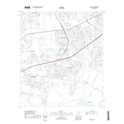
2019 Map of Sugar Land
USGS Topo · Published 2019About this map
The Brazos River carves a winding path through this portion of Fort Bend County, defining a landscape where suburban expansion meets historic Texas settlements. The corridor between Richmond and Rosenberg shows significant modern development, yet older rural landmarks persist in the surrounding acreage. Genealogists will find several burial sites preserved amidst the shifting land use, including New Home Cem near the Pumpkin Lakes and Sandberry Cem located just north of the Crabb community. To the south and east, the terrain opens into a complex network of waterways including Smithers Lake, House Bayou, and Gapps Slough. This modern survey documents the density of communities like Greatwood and Pecan Grove as they wrap around the river’s oxbows, while smaller locales such as Booth and Thompsons maintain their positions along the southern rail and road routes.
Find a feature on this map
30 named features on this map. Tap any name to fly to it.
Don’t see what you’re looking for? This feature index may not catch every label — zoom into the map to look around manually.
Map Details
Editions of this 2019 Sugar Land Map
This is the sole edition of this map. No revisions or reprints were ever made.
Other maps of this area

1915 · Alief
USGS Topo · 1:24,000

1915 · Clodine
USGS Topo · 1:24,000

1919 · Clodine
USGS Topo · 1:31,680

1950 · Houston
USGS Topo · 1:250,000

1953 · Needville
USGS Topo · 1:24,000

1953 · Lake George
USGS Topo · 1:24,000

1953 · Thompsons
USGS Topo · 1:24,000

1955 · Sugar Land
USGS Topo · 1:62,500

1955 · Richmond
USGS Topo · 1:62,500

1956 · Houston
USGS Topo · 1:250,000