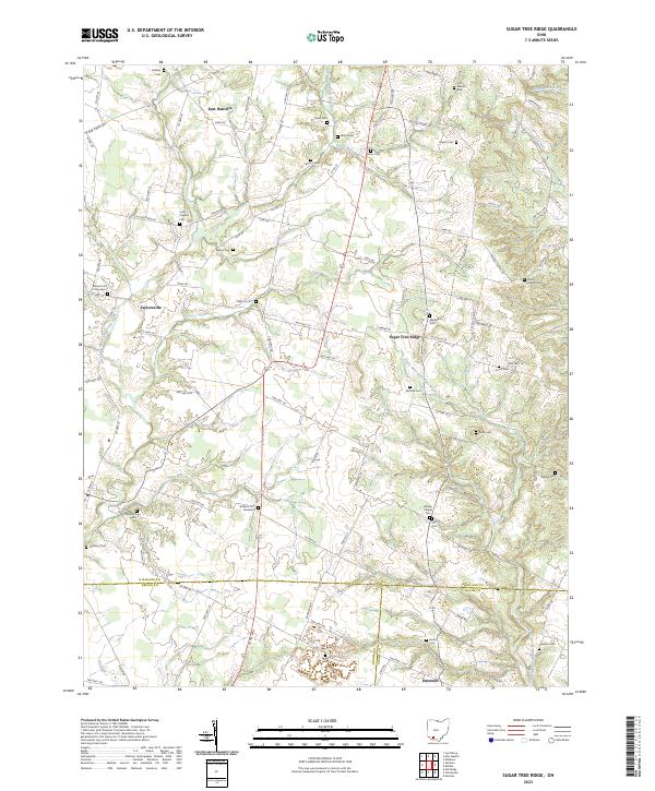
2023 Map of Sugar Tree Ridge
USGS Topo · Published 2023About this map
Sugar Tree Ridge serves as a central landmark in this southwestern Ohio landscape, where the headwaters of several significant drainages converge. The map documents a rural region defined by its dispersed settlements and a high density of family and community burial grounds, such as Carrier Cem and Van Winkle Cem. The terrain is carved by the Little West Fork Ohio Brush Creek and Plum Run, creating a rolling topography that influenced the placement of early homesteads and church-centered communities like East Danville and Emerald.
Find a feature on this map
106 named features on this map. Tap any name to fly to it.
Don’t see what you’re looking for? This feature index may not catch every label — zoom into the map to look around manually.
Map Details
Editions of this 2023 Sugar Tree Ridge Map
This is the sole edition of this map. No revisions or reprints were ever made.
Other maps of this area

1917 · Hillsboro
USGS Topo · 1:62,500

1917 · Sardinia
USGS Topo · 1:62,500

1918 · Seaman
USGS Topo · 1:62,500

1928 · Higginsport
USGS Topo · 1:48,000

1931 · Higginsport
USGS Topo · 1:62,500

1944 · Hillsboro
USGS Topo · 1:62,500

1944 · Sardinia
USGS Topo · 1:62,500

1947 · Columbus
USGS Topo · 1:250,000

1957 · Huntington
USGS Topo · 1:250,000

1960 · Huntington
USGS Topo · 1:250,000