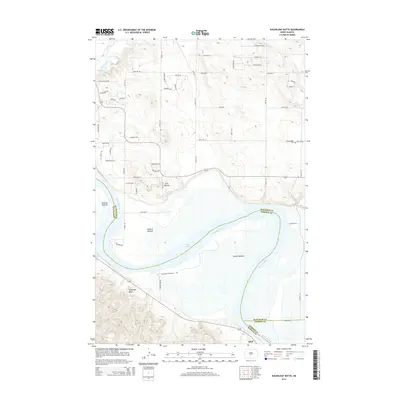
2014 Map of Sugarloaf Butte
USGS Topo · Published 2014About this map
The Missouri River carves a winding path through the heart of this landscape south of Bismarck, defining the border between Morton and Burleigh counties. Along its banks, the river's historical meanderings have created extensive lowland flats such as Schmidt Bottom, Kimball Bottom, and Graner Bottom. These low-lying areas transition into the waters of Lake Oahe, illustrating the modern management of the Missouri's flow through the Dakotas.
Find a feature on this map
42 named features on this map. Tap any name to fly to it.
Don’t see what you’re looking for? This feature index may not catch every label — zoom into the map to look around manually.
Map Details
Editions of this 2014 Sugarloaf Butte Map
This is the sole edition of this map. No revisions or reprints were ever made.
Other maps of this area

1907 · Bismarck
USGS Topo · 1:125,000

1950 · Bismarck
USGS Topo · 1:24,000

1951 · Menoken SW
USGS Topo · 1:24,000

1951 · Bismarck
USGS Topo · 1:62,500

1951 · Menoken
USGS Topo · 1:62,500

1954 · Bismarck
USGS Topo · 1:250,000

1958 · Bismarck
USGS Topo · 1:250,000

1962 · Sugarloaf Butte
USGS Topo · 1:24,000

1962 · Schmidt
USGS Topo · 1:24,000

1962 · Menoken SW
USGS Topo · 1:24,000