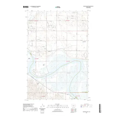
2020 Map of Sugarloaf Butte
USGS Topo · Published 2020About this map
The Missouri River defines the landscape of this southern North Dakota region, carving a wide valley floor marked by extensive floodplain features like Graner Bottom, Kimball Bottom, and Schmidt Bottom. Rising above these alluvial levels, the distinctive elevations of Sugarloaf Butte and Twin Buttes serve as prominent landmarks overlooking the river’s winding course and the waters of Lake Oahe. The map details the border area where Burleigh, Morton, and Emmons counties converge, showing a mix of established rural infrastructure and newer residential development.
Find a feature on this map
44 named features on this map. Tap any name to fly to it.
Don’t see what you’re looking for? This feature index may not catch every label — zoom into the map to look around manually.
Map Details
Editions of this 2020 Sugarloaf Butte Map
This is the sole edition of this map. No revisions or reprints were ever made.
Other maps of this area

1907 · Bismarck
USGS Topo · 1:125,000

1950 · Bismarck
USGS Topo · 1:24,000

1951 · Menoken SW
USGS Topo · 1:24,000

1951 · Bismarck
USGS Topo · 1:62,500

1951 · Menoken
USGS Topo · 1:62,500

1954 · Bismarck
USGS Topo · 1:250,000

1958 · Bismarck
USGS Topo · 1:250,000

1962 · Sugarloaf Butte
USGS Topo · 1:24,000

1962 · Schmidt
USGS Topo · 1:24,000

1962 · Menoken SW
USGS Topo · 1:24,000