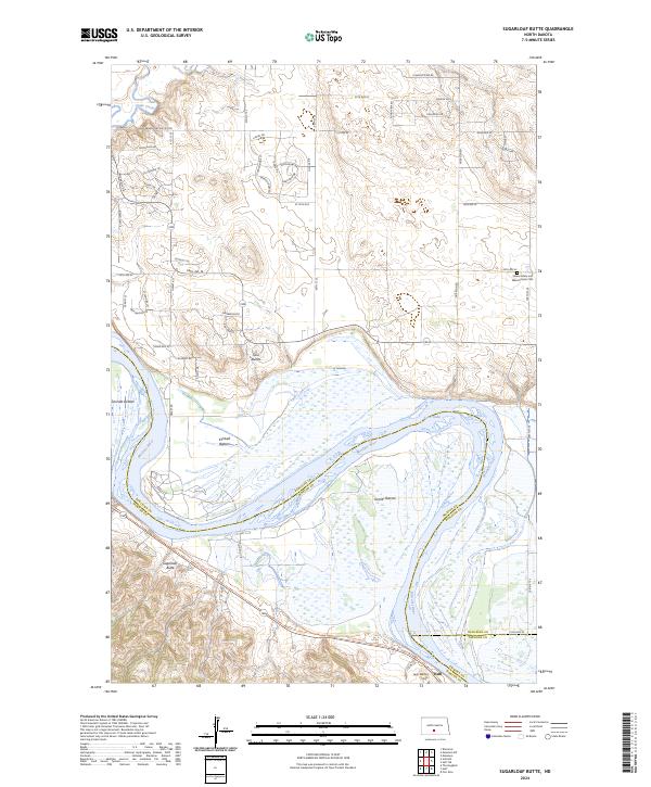
2024 Map of Sugarloaf Butte
USGS Topo · Published 2024About this map
The Missouri River carves a massive loop through the center of this landscape south of Bismarck, defining the boundaries between Burleigh, Morton, and Emmons counties. The river valley is characterized by broad alluvial flats such as Schmidt Bottom, Kimball Bottom, and Graner Bottom, which sit in the shadow of prominent topographical features like Sugarloaf Butte and the Twin Buttes. These landforms provided natural overlooks and landmarks for travelers along the river and early settlers in the region.
Find a feature on this map
63 named features on this map. Tap any name to fly to it.
Don’t see what you’re looking for? This feature index may not catch every label — zoom into the map to look around manually.
Map Details
Editions of this 2024 Sugarloaf Butte Map
This is the sole edition of this map. No revisions or reprints were ever made.
Other maps of this area

1907 · Bismarck
USGS Topo · 1:125,000

1950 · Bismarck
USGS Topo · 1:24,000

1951 · Menoken SW
USGS Topo · 1:24,000

1951 · Bismarck
USGS Topo · 1:62,500

1951 · Menoken
USGS Topo · 1:62,500

1954 · Bismarck
USGS Topo · 1:250,000

1958 · Bismarck
USGS Topo · 1:250,000

1962 · Sugarloaf Butte
USGS Topo · 1:24,000

1962 · Schmidt
USGS Topo · 1:24,000

1962 · Menoken SW
USGS Topo · 1:24,000