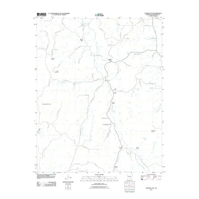
2011 Map of Sulphur City
USGS Topo · Published 2011About this map
Sulphur City and the surrounding rural landscape of Washington County are defined by a network of ridges and hollows that shape the local drainage into the Middle Fork White River. This topography creates a distinct settlement pattern where clusters of homes and small communities like Black Oak and Hicks are positioned near significant water sources such as Trace Creek and Parker Branch. The map reveals a deeply rooted local history through its numerous burial grounds, including Salem Cemetery, Kings Cemetery, and Zion Cemetery, which are scattered among family-named terrain features like George West Hollow and Richardson Hollow. These landforms and small-scale settlements demonstrate how the residents have utilized the natural geography, with Tatum Spring and Greasy Creek serving as vital landmarks in this upland environment southeast of Fayetteville.
Find a feature on this map
78 named features on this map. Tap any name to fly to it.
Don’t see what you’re looking for? This feature index may not catch every label — zoom into the map to look around manually.
Map Details
Editions of this 2011 Sulphur City Map
This is the sole edition of this map. No revisions or reprints were ever made.
Other maps of this area

1898 · Winslow
USGS Topo · 1:125,000

1899 · Fayetteville
USGS Topo · 1:125,000

1900 · Eureka Springs
USGS Topo · 1:125,000

1901 · Winslow
USGS Topo · 1:125,000

1901 · Eureka Springs
USGS Topo · 1:125,000

1901 · Fayetteville
USGS Topo · 1:125,000

1904 · Fayetteville
USGS Topo · 1:125,000

1943 · St. Paul
USGS Topo · 1:62,500

1945 · Harrison
USGS Topo · 1:250,000

1946 · St. Paul
USGS Topo · 1:62,500