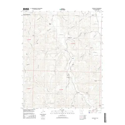
2017 Map of Sulphur City
USGS Topo · Published 2017About this map
Sulphur City and the surrounding Arkansas highlands south of Elkins are defined by a complex network of hollows and ridges that dictated the pattern of local settlement. This 2017 topographic survey shows how the landscape is punctuated by family and community landmarks, including Kings Cem, Salem Cem, and Zion Cem, which often represent the early centers of rural neighborhoods. The terrain rises to notable peaks like Lingebough Mtn and Snyder Mtn, while the drainage system of Greasy Cr and the Middle Fork White River provided the essential water resources for early homesteads. Small rural hubs such as Black Oak, Hicks, and Arnett persist along the winding county roads, often positioned near natural features like Tatum Spring. The map documents a classic Ozark transition zone where the growing reach of Fayetteville meets the enduring agricultural and residential character of Washington County's valleys.
Find a feature on this map
100 named features on this map. Tap any name to fly to it.
Don’t see what you’re looking for? This feature index may not catch every label — zoom into the map to look around manually.
Map Details
Editions of this 2017 Sulphur City Map
This is the sole edition of this map. No revisions or reprints were ever made.
Other maps of this area

1898 · Winslow
USGS Topo · 1:125,000

1899 · Fayetteville
USGS Topo · 1:125,000

1900 · Eureka Springs
USGS Topo · 1:125,000

1901 · Winslow
USGS Topo · 1:125,000

1901 · Eureka Springs
USGS Topo · 1:125,000

1901 · Fayetteville
USGS Topo · 1:125,000

1904 · Fayetteville
USGS Topo · 1:125,000

1943 · St. Paul
USGS Topo · 1:62,500

1945 · Harrison
USGS Topo · 1:250,000

1946 · St. Paul
USGS Topo · 1:62,500