
1963 Map of Sulphur South
USGS Topo · Published 1964About this map
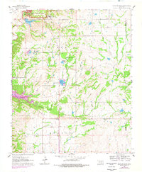
Platt National Park and the southern outskirts of Sulphur anchor the northern edge of this 1963 survey, revealing a landscape defined by mineral springs and a growing state infrastructure. The map documents the State Veterans Hospital and Veterans Lake near the city center, while the rugged terrain to the south is marked by numerous natural resources including a Fish Hatchery and various Mines and gravel pits.
Find a feature on this map
27 named features on this map. Tap any name to fly to it.
Don’t see what you’re looking for? This feature index may not catch every label — zoom into the map to look around manually.
Map Details
Editions of this 1963 Sulphur South Map
2 editions found
Other maps of this area

1898 · Pauls Valley
USGS Topo · 1:125,000

1901 · Stonewall
USGS Topo · 1:125,000

1901 · Tishomingo
USGS Topo · 1:125,000

1901 · Ardmore
USGS Topo · 1:125,000

1902 · Pauls Valley
USGS Topo · 1:125,000

1918 · Ardmore
USGS Topo · 1:125,000

1957 · Ardmore
USGS Topo · 1:250,000

1963 · Ardmore
USGS Topo · 1:250,000

1963 · Mill Creek
USGS Topo · 1:24,000

1963 · Troy
USGS Topo · 1:24,000