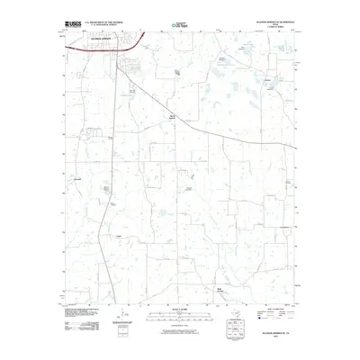
2010 Map of Sulphur Springs SE
USGS Topo · Published 2010About this map
Sulphur Springs expands southward along the Arbala Rd and FM 2297 corridors, transitioning from the urban center into the agrarian landscape of East Texas. Small, distinct communities and named landmarks characterize this area, including Martin Springs and Tazewell in the central-west, and Reilly Springs to the south. The rural character is reinforced by numerous family and community landmarks such as Shooks Chapel and the Melton Cemetery, which serve as vital points of reference for local family history.
Find a feature on this map
68 named features on this map. Tap any name to fly to it.
Don’t see what you’re looking for? This feature index may not catch every label — zoom into the map to look around manually.
Map Details
Editions of this 2010 Sulphur Springs SE Map
This is the sole edition of this map. No revisions or reprints were ever made.
Other maps of this area

1953 · Texarkana
USGS Topo · 1:250,000

1956 · Texarkana
USGS Topo · 1:250,000

1956 · Tyler
USGS Topo · 1:250,000

1958 · Arbala
USGS Topo · 1:24,000

1959 · Yantis
USGS Topo · 1:24,000

1959 · Alba
USGS Topo · 1:62,500

1960 · Pleasant Grove
USGS Topo · 1:24,000

1962 · Brashear
USGS Topo · 1:24,000

1964 · Como
USGS Topo · 1:24,000

1964 · Sulphur Springs
USGS Topo · 1:24,000