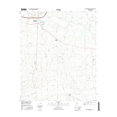
2016 Map of Sulphur Springs SE
USGS Topo · Published 2016About this map
Sulphur Springs anchors the northwest corner of this East Texas terrain, where the transition from urban streets to rural ranch land is marked by numerous small reservoirs and winding creek beds. The landscape southeast of the city is defined by a network of drainage systems including Running Cr and Gideon Cr, which support localized water bodies such as Alberta Lake Elberta Lake and Stewart Lake. These water resources have historically influenced the placement of rural communities like Martin Springs and Reilly Springs. Genealogists will find significant value in the documentation of several burial grounds, including the large Restlawn Memorial Cem near the city and the more remote Gamblin Cem to the east. The road network, comprising several Farm to Market roads and numerous county routes, illustrates the enduring rural infrastructure that connects these outlying settlements to the Hopkins County seat.
Find a feature on this map
96 named features on this map. Tap any name to fly to it.
Don’t see what you’re looking for? This feature index may not catch every label — zoom into the map to look around manually.
Map Details
Editions of this 2016 Sulphur Springs SE Map
This is the sole edition of this map. No revisions or reprints were ever made.
Other maps of this area

1953 · Texarkana
USGS Topo · 1:250,000

1956 · Texarkana
USGS Topo · 1:250,000

1956 · Tyler
USGS Topo · 1:250,000

1958 · Arbala
USGS Topo · 1:24,000

1959 · Yantis
USGS Topo · 1:24,000

1959 · Alba
USGS Topo · 1:62,500

1960 · Pleasant Grove
USGS Topo · 1:24,000

1962 · Brashear
USGS Topo · 1:24,000

1964 · Como
USGS Topo · 1:24,000

1964 · Sulphur Springs
USGS Topo · 1:24,000