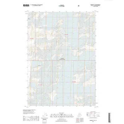
2018 Map of Sumdum B-3 SE
USGS Topo · Published 2018About this map
Tongass National Forest encompasses this high-altitude Alaskan landscape, where the massive ice fields of the Coast Mountains define the physical geography. The sheet is dominated by the glacial reach of the Dawes Glacier and North Arm Glacier, illustrating the complex drainage patterns and ice-carved topography of the Petersburg Borough region. Unlike many maps of the period that emphasize human settlement, this survey reveals a primitive wilderness characterized by dramatic elevation changes, ranging from sea-level inlets to the prominent peak of Hump Knoll. The technical detail of the ice contours provides an invaluable record for understanding the glaciology of this corner of Southeast Alaska as it appeared in the early twenty-first century.
Find a feature on this map
9 named features on this map. Tap any name to fly to it.
Don’t see what you’re looking for? This feature index may not catch every label — zoom into the map to look around manually.
Map Details
Editions of this 2018 Sumdum B-3 SE Map
This is the sole edition of this map. No revisions or reprints were ever made.
Other maps of this area

1952 · Sumdum
USGS Topo · 1:250,000

1961 · Sumdum A-2
USGS Topo · 1:63,360

1961 · Sumdum B-2
USGS Topo · 1:63,360

1961 · Sumdum A-3
USGS Topo · 1:63,360

1961 · Sumdum B-3
USGS Topo · 1:63,360

1961 · Sumdum
USGS Topo · 1:250,000

1996 · Sumdum B-3
USGS Topo · 1:63,360

2000 · Sumdum A-2
USGS Topo · 1:63,360

2000 · Sumdum B-2
USGS Topo · 1:63,360
2018 · Sumdum B-2 SW
USGS Topo · 1:25,000