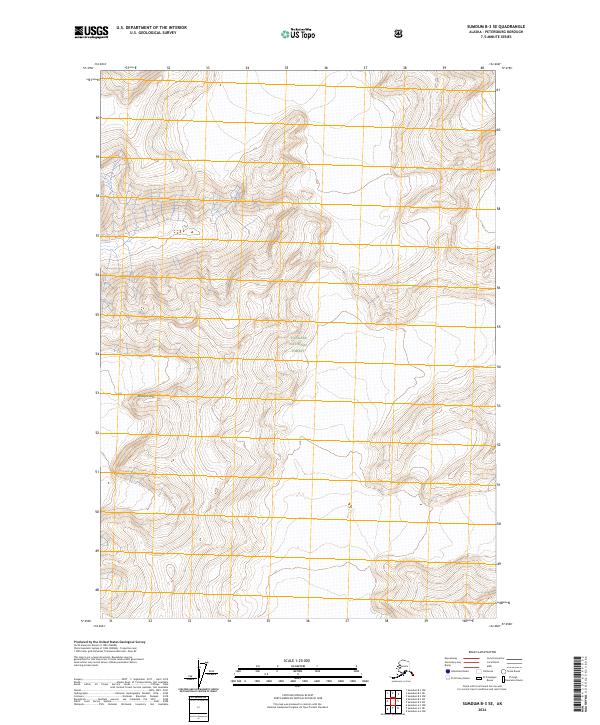
2024 Map of Sumdum B-3 SE
USGS Topo · Published 2024About this map
The Tracy Arm-Fords Terror Wilderness occupies the northwestern corner of this territory, marking a landscape defined by extreme relief and preserved wilderness. This corner of the Tongass National Forest is characterized by high-elevation peaks and complex drainage patterns, with Hump Knoll serving as a distinct named landmark amidst the unnamed ridges. The map meticulously documents the Public Land Survey System grid, including the convergence of t52s r78e and t52s r79e, providing essential spatial data for navigating this roadless Alaskan interior. The absence of human-built infrastructure highlights the isolation of the Petersen Borough region, where the terrain itself is the primary subject of study.
Find a feature on this map
7 named features on this map. Tap any name to fly to it.
Don’t see what you’re looking for? This feature index may not catch every label — zoom into the map to look around manually.
Map Details
Editions of this 2024 Sumdum B-3 SE Map
This is the sole edition of this map. No revisions or reprints were ever made.
Other maps of this area

1952 · Sumdum
USGS Topo · 1:250,000

1961 · Sumdum A-2
USGS Topo · 1:63,360

1961 · Sumdum B-2
USGS Topo · 1:63,360

1961 · Sumdum A-3
USGS Topo · 1:63,360

1961 · Sumdum B-3
USGS Topo · 1:63,360

1961 · Sumdum
USGS Topo · 1:250,000

1996 · Sumdum B-3
USGS Topo · 1:63,360

2000 · Sumdum A-2
USGS Topo · 1:63,360

2000 · Sumdum B-2
USGS Topo · 1:63,360
2018 · Sumdum B-2 SW
USGS Topo · 1:25,000