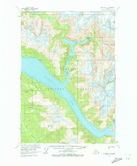
1961 Map of Sumdum C-4
USGS Topo · Published 1973About this map
Tongass National Forest surrounds the deep glacial carved waters of Endicott Arm in this early 1960s topographic survey. The landscape is defined by the stark transition from marine inlets to high ice fields, where Brown Glacier and multiple crevasses dominate the eastern heights. The drainage patterns of Sylvia Creek and Spruce Creek reveal the steep, intricate drainage basins typical of this coastal wilderness.
Find a feature on this map
12 named features on this map. Tap any name to fly to it.
Don’t see what you’re looking for? This feature index may not catch every label — zoom into the map to look around manually.
Map Details
Editions of this 1961 Sumdum C-4 Map
2 editions found

Other maps of this area

1943 · Sumdum B-4
USGS Topo · 1:63,360

1948 · Sumdum C-5
USGS Topo · 1:63,360

1948 · Sumdum B-5
USGS Topo · 1:63,360

1948 · Sumdum D-5
USGS Topo · 1:63,360

1948 · Sumdum B-4
USGS Topo · 1:63,360

1951 · Sumdum C-5
USGS Topo · 1:63,360

1951 · Sumdum B-5
USGS Topo · 1:63,360

1952 · Sumdum
USGS Topo · 1:250,000

1955 · Sumdum D-5
USGS Topo · 1:63,360

1960 · Sumdum D-4
USGS Topo · 1:63,360