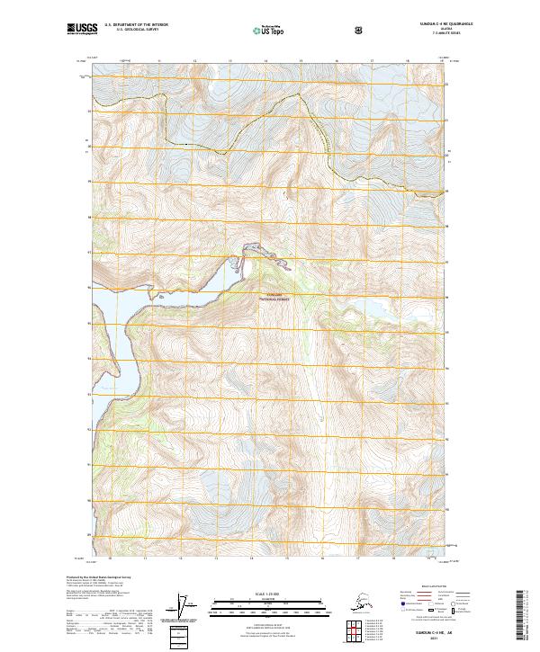
2021 Map of Sumdum C-4 NE
USGS Topo · Published 2021About this map
Tongass National Forest dominates this coastal Alaska landscape, where massive ice fields and deep glacial fjords define the topography. The map centers on the high-altitude interface between the North Sawyer Glacier and the South Sawyer Glacier, showcasing the dramatic elevation changes characteristic of the region. To the west, the waters of Fords Terror cut into the mainland, illustrating the steep-walled inlets that provide access to this wilderness. This 2021 edition reflects the modern boundaries of the Hoonah-Angoon Census Area and the Petersburg Borough, which meet along the high mountain ridges. The lack of roads or established settlements emphasizes the character of the area as a protected maritime forest and glacial preserve, where geographic features are the primary landmarks for navigation.
Find a feature on this map
5 named features on this map. Tap any name to fly to it.
Don’t see what you’re looking for? This feature index may not catch every label — zoom into the map to look around manually.
Map Details
Editions of this 2021 Sumdum C-4 NE Map
This is the sole edition of this map. No revisions or reprints were ever made.
Other maps of this area

1952 · Sumdum
USGS Topo · 1:250,000

1960 · Sumdum D-4
USGS Topo · 1:63,360

1961 · Sumdum D-3
USGS Topo · 1:63,360

1961 · Sumdum C-3
USGS Topo · 1:63,360

1961 · Sumdum C-4
USGS Topo · 1:63,360

1961 · Sumdum
USGS Topo · 1:250,000
1994 · Sumdum D-4
USGS Topo · 1:63,360

2000 · Sumdum C-3
USGS Topo · 1:63,360
2017 · Sumdum C-4 NW
USGS Topo · 1:25,000
2017 · Sumdum D-4 SW
USGS Topo · 1:25,000