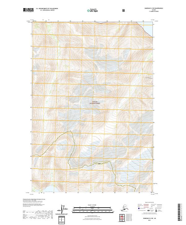
2021 Map of Sumdum D-4 SW
USGS Topo · Published 2021About this map
Tongass National Forest dominates this Alaskan wilderness, where the high elevations of the Coast Mountains define the physical landscape. This 2021 survey illustrates the remote borderlands where the Hoonah-Angoon Census Area meets the Petersburg Borough. The map captures a largely untouched environment, characterized by steep elevation changes and extensive glacial or ice-covered terrain typical of the region's high-latitude maritime climate. The lack of infrastructure or named settlements highlights the area's role as a vast protected forest and mountain range, serving as a baseline for modern topographic study and resource management in Southeast Alaska.
Find a feature on this map
3 named features on this map. Tap any name to fly to it.
Don’t see what you’re looking for? This feature index may not catch every label — zoom into the map to look around manually.
Map Details
Editions of this 2021 Sumdum D-4 SW Map
This is the sole edition of this map. No revisions or reprints were ever made.
Other maps of this area

1948 · Sumdum C-5
USGS Topo · 1:63,360

1948 · Sumdum D-5
USGS Topo · 1:63,360

1951 · Sumdum C-5
USGS Topo · 1:63,360

1952 · Sumdum
USGS Topo · 1:250,000

1955 · Sumdum D-5
USGS Topo · 1:63,360

1960 · Sumdum D-4
USGS Topo · 1:63,360

1961 · Sumdum C-4
USGS Topo · 1:63,360

1961 · Sumdum
USGS Topo · 1:250,000
1994 · Sumdum D-5
USGS Topo · 1:63,360
1994 · Sumdum D-4
USGS Topo · 1:63,360