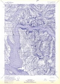
1955 Map of Sumdum D-5
USGS Topo · Published 1963About this map
Mt Sumdum towers over the dramatic glacial landscapes of the Tongass National Forest in this mid-century survey. The geography is defined by the deep fjords of Tracy Arm and Endicott Arm, which converge into Holkham Bay near Harbor Island. A rare mark of human habitation appears at Indian Village (Aban) near the mouth of Powers Creek, alongside a solitary Cabin situated on the western shore. The interior terrain is marked by significant glacial activity, with prominent Crevasses shown on the ice fields surrounding the peaks. To the north, the elevation drops toward the basins of Upper Sweetheart Lake and Lower Sweetheart Lake, while Gilbert Creek drains the steep slopes of the western ridges. This map documents a wilderness at the intersection of maritime and alpine environments before modern shifts in ice coverage altered the coastline.
Find a feature on this map
17 named features on this map. Tap any name to fly to it.
Don’t see what you’re looking for? This feature index may not catch every label — zoom into the map to look around manually.
Map Details
Editions of this 1955 Sumdum D-5 Map
3 editions found

Other maps of this area

1948 · Sumdum D-6
USGS Topo · 1:63,360

1948 · Sumdum C-5
USGS Topo · 1:63,360

1948 · Sumdum C-6
USGS Topo · 1:63,360

1948 · Sumdum D-5
USGS Topo · 1:63,360

1951 · Taku River A-4
USGS Topo · 1:63,360

1951 · Taku River A-5
USGS Topo · 1:63,360

1951 · Taku River A-6
USGS Topo · 1:63,360

1951 · Sumdum C-5
USGS Topo · 1:63,360

1951 · Sumdum D-6
USGS Topo · 1:63,360

1951 · Sumdum C-6
USGS Topo · 1:63,360