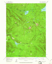
1956 Map of Summit Lake
USGS Topo · Published 1961About this map
Summit Lake and its surrounding high-country watersheds define this mid-century survey of the Oregon Cascades. The map shows a landscape undergoing significant hydroelectric and recreational development, most notably at Lemolo Lake where a dam, spillway, and generator are marked along the North Umpqua River. This infrastructure appears alongside temporary structures like the Construction Camp and a gaging station, documenting the transformation of the river for power.
Find a feature on this map
97 named features on this map. Tap any name to fly to it.
Don’t see what you’re looking for? This feature index may not catch every label — zoom into the map to look around manually.
Map Details
Editions of this 1956 Summit Lake Map
3 editions found

Other maps of this area

1917 · Diamond Lake
USGS Topo · 1:125,000

1925 · Waldo Lake
USGS Topo · 1:125,000

1930 · Maiden Peak
USGS Topo · 1:125,000

1934 · Maiden Peak
USGS Topo · 1:125,000

1935 · Chemult
USGS Topo · 1:96,000

1941 · Chemult
USGS Topo · 1:125,000

1955 · Crescent
USGS Topo · 1:250,000

1956 · Toketee Falls
USGS Topo · 1:62,500

1956 · Diamond Lake
USGS Topo · 1:62,500

1956 · Waldo Lake
USGS Topo · 1:62,500