1931 Map of Sumner
USGS Topo · Published 1954About this map
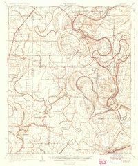
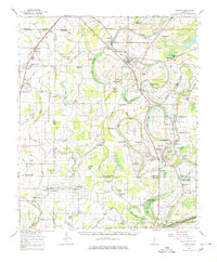
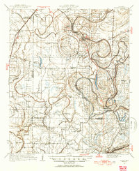
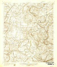
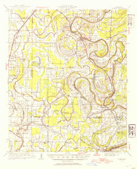
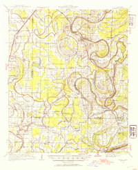
The Tallahatchie River and Cassidy Bayou dominate this 1931 survey of the Mississippi Delta, carving a complex landscape of oxbows and brakes across Sumner and Glendora. The territory is defined by its agricultural and institutional footprints, most notably the State Reservation near Parchman and numerous tenant-era landmarks. Significant for genealogical research, the map identifies dozens of community anchors like the Brooks Rosenwald Sch, St Peter Sch, and Mercy Seat Ch. The Yazoo and Mississippi Valley railroad parallels the river, connecting riverside settlements like Webb and Minter City. Ancient history is also visible in the Indian Mounds located near Snow Brake, standing in contrast to the early 20th-century drainage network of Staten Brake and Blue Lake. This landscape reflects the heavy reliance on seasonal waterways and rail for both commerce and community life before the modern highway era.
Find a feature on this map
82 named features on this map. Tap any name to fly to it.
Don’t see what you’re looking for? This feature index may not catch every label — zoom into the map to look around manually.
Map Details
Editions of this 1931 Sumner Map
4 editions found
Historical Maps of Webb Through Time
4 maps found