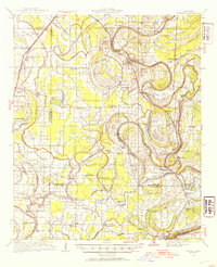
1931 Map of Sumner
USGS Topo · Published 1954About this map
Sumner and the surrounding Mississippi Delta landscape are defined by the intricate winding of the Yazoo River, Tallahatchie River, and Quiver River. This 1931 survey reveals a territory dense with small rural congregations and educational landmarks, including the Brooks Rosenwald Sch, Rolling Waters Sch, and Jacobs Chapel Sch. The presence of the State Reservation at Parchman and the scattered Indian Mounds and Allen Mounds speak to the deep layers of land use in Tallahatchie County.
Find a feature on this map
79 named features on this map. Tap any name to fly to it.
Don’t see what you’re looking for? This feature index may not catch every label — zoom into the map to look around manually.
Map Details
Editions of this 1931 Sumner Map
4 editions found
Other maps of this area

1931 · Schlater
USGS Topo · 1:48,000

1931 · Sumner
USGS Topo · 1:48,000

1931 · Drew
USGS Topo · 1:48,000

1932 · Philipp
USGS Topo · 1:48,000

1932 · Tutwiler
USGS Topo · 1:48,000

1934 · Cleveland
USGS Topo · 1:62,500

1934 · Schlater
USGS Topo · 1:62,500

1935 · Clarksdale
USGS Topo · 1:62,500

1935 · Crowder
USGS Topo · 1:62,500

1935 · Sumner
USGS Topo · 1:62,500