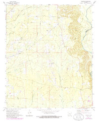
1971 Map of Sumpter
USGS Topo · Published 1986About this map
Sumpter and the surrounding timberlands of Bradley County are defined by the winding course of the Saline River, which forms the eastern boundary of this 1970s landscape. Small rural communities and church-centered settlements like Mt Olive and Simpson are connected by a network of local roads and an extensive Pipeline corridor. The area's industrial past is visible in the long stretches of the Old Railroad Grade and numerous Gravel Pits that punctuate the terrain. For genealogists and local historians, the map provides precise locations for the Pattsville Cem and Outlaw Cem, along with established landmarks like Hickory Spring Ch. The drainage patterns of Snake Creek and Beech Creek illustrate the low-lying, water-rich environment that shaped early settlement patterns and transportation routes in this part of Arkansas.
Find a feature on this map
20 named features on this map. Tap any name to fly to it.
Don’t see what you’re looking for? This feature index may not catch every label — zoom into the map to look around manually.
Map Details
Editions of this 1971 Sumpter Map
2 editions found
Other maps of this area

1934 · Ingalls
USGS Topo · 1:48,000

1937 · Ingalls
USGS Topo · 1:62,500

1939 · Ingalls
USGS Topo · 1:62,500

1953 · Greenwood
USGS Topo · 1:250,000

1953 · El Dorado
USGS Topo · 1:250,000

1956 · Greenwood
USGS Topo · 1:250,000

1957 · El Dorado
USGS Topo · 1:250,000

1958 · El Dorado
USGS Topo · 1:250,000

1960 · El Dorado
USGS Topo · 1:250,000
1971 · Vick
USGS Topo · 1:24,000