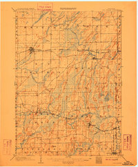
1907 Map of Sun Prairie
USGS Topo · Published 1910About this map
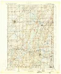
Glacial drumlins and wetland pockets define the landscape of eastern Dane County during this early twentieth-century survey. The terrain is marked by a distinct northeast-to-southwest grain of ridges and lowlands, most notably seen at Liberty Mound and the sprawling Brazee Swamp. This period shows a well-established network of agricultural hubs connected by a dense lattice of steel. Three major rail lines, including the Chicago Milwaukee and St Paul RR and the Chicago Northwestern RR, serve as the primary lifelines for rural communities like Deansville, Marshall, and Deerfield.
Find a feature on this map
41 named features on this map. Tap any name to fly to it.
Don’t see what you’re looking for? This feature index may not catch every label — zoom into the map to look around manually.
Map Details
Editions of this 1907 Sun Prairie Map
8 editions found

Other maps of this area

1889 · Evansville
USGS Topo · 1:62,500

1890 · Madison
USGS Topo · 1:62,500

1890 · Sun Prairie
USGS Topo · 1:62,500

1890 · Stoughton
USGS Topo · 1:62,500

1891 · Waterloo
USGS Topo · 1:62,500

1891 · Koshkonong
USGS Topo · 1:62,500

1892 · Madison
USGS Topo · 1:62,500

1894 · Waterloo
USGS Topo · 1:62,500

1894 · Evansville
USGS Topo · 1:62,500

1894 · Koshkonong
USGS Topo · 1:62,500