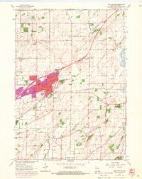
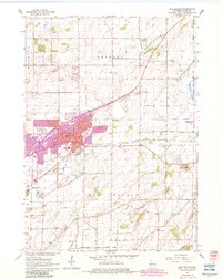
1962 Map of Sun Prairie
USGS Topo · Published 1970About this map
Sun Prairie serves as the focal point of this regional study, which highlights significant urban expansion recorded during the 1960s. The map distinguishes established structures from newer developments through purple tinting, particularly around Angell Park and the northeastern residential corridors. The community's industrial and logistical foundations are clear, with the Chicago Milwaukee St Paul and Pacific railroad bisecting the township and supporting local commerce near the Sewage Disposal and various quarries.
Find a feature on this map
24 named features on this map. Tap any name to fly to it.
Don’t see what you’re looking for? This feature index may not catch every label — zoom into the map to look around manually.
Map Details
Editions of this 1962 Sun Prairie Map
5 editions found
Other maps of this area

1890 · Madison
USGS Topo · 1:62,500

1890 · Sun Prairie
USGS Topo · 1:62,500

1892 · Madison
USGS Topo · 1:62,500

1896 · Sun Prairie
USGS Topo · 1:62,500

1901 · Poynette
USGS Topo · 1:62,500

1904 · Madison
USGS Topo · 1:62,500

1905 · Sun Prairie
USGS Topo · 1:62,500

1906 · Madison
USGS Topo · 1:62,500

1907 · Sun Prairie
USGS Topo · 1:62,500

1955 · Columbus
USGS Topo · 1:62,500