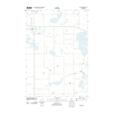
2010 Map of Sunburg
USGS Topo · Published 2010About this map
Sunburg stands as the primary settlement in this corner of Kandiyohi County, anchored by the Sunburg Post Office and surrounded by a dense network of Lutheran parish cemeteries that speak to the area's Norwegian heritage. The landscape is defined by its glacial heritage, featuring numerous basins like Glesne Lake and Norway Lake, as well as significant dry beds such as Sand Lakebed and West Lakebed. These former lake bottoms, now integrated into the agricultural grid, are managed by an extensive drainage system including County Ditch Number Fifteen and County Ditch Number Twentynine. For the genealogist, the distribution of burial sites like the West Norway Lake Cemetery and Nannestad Cemetery provides a clear map of early congregation boundaries and family clusters throughout the township at the start of the 21st century.
Find a feature on this map
36 named features on this map. Tap any name to fly to it.
Don’t see what you’re looking for? This feature index may not catch every label — zoom into the map to look around manually.
Map Details
Editions of this 2010 Sunburg Map
This is the sole edition of this map. No revisions or reprints were ever made.
Other maps of this area

1953 · Saint Cloud
USGS Topo · 1:250,000

1957 · Saint Cloud
USGS Topo · 1:250,000

1958 · Saint Cloud
USGS Topo · 1:250,000

1958 · Kerkhoven
USGS Topo · 1:24,000

1958 · Pennock
USGS Topo · 1:24,000

1958 · Solomon Lake
USGS Topo · 1:24,000

1967 · Mount Tom
USGS Topo · 1:24,000

1967 · Sunburg
USGS Topo · 1:24,000

1967 · Belgrade
USGS Topo · 1:24,000

1967 · Lake Johanna
USGS Topo · 1:24,000