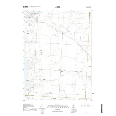
2019 Map of Sunbury
USGS Topo · Published 2019About this map
Sunbury and Galena anchor this part of Delaware County, where the landscape is defined by the branching waters of Big Walnut Creek and its many tributaries. The area's agricultural roots are evident in the numerous small family and community burial grounds, such as Vans Valley Cem and Maple Grove Cem, which dot the townships of Harlem and Center Village. Significant water management features, including Sunbury Upground Reservoir Number One, reflect the region's infrastructure development alongside the northern reaches of the Hoover Reservoir. The map detail captures a network of rural roads and township highways like Twp Hwy 29 and Co Rd 44, tracing the boundaries where Delaware County meets Licking and Franklin counties. This documentation of the terrain preserves the locations of numerous historic cemeteries and small crossroads settlements that have served these central Ohio farming communities for generations.
Find a feature on this map
117 named features on this map. Tap any name to fly to it.
Don’t see what you’re looking for? This feature index may not catch every label — zoom into the map to look around manually.
Map Details
Editions of this 2019 Sunbury Map
This is the sole edition of this map. No revisions or reprints were ever made.
Other maps of this area

1902 · Westerville
USGS Topo · 1:62,500

1904 · Westerville
USGS Topo · 1:62,500

1908 · Granville
USGS Topo · 1:62,500

1910 · Granville
USGS Topo · 1:62,500

1915 · Marengo
USGS Topo · 1:62,500

1915 · Fredericktown
USGS Topo · 1:62,500

1943 · Marengo
USGS Topo · 1:62,500

1943 · Fredericktown
USGS Topo · 1:62,500

1950 · Marion
USGS Topo · 1:250,000
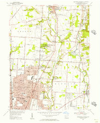
1954 · Northeast Columbus
USGS Topo · 1:24,000