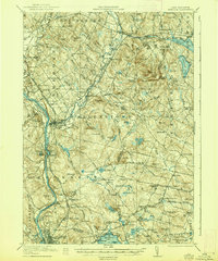
1921 Map of Suncook
USGS Topo · Published 1938About this map
The Suncook River serves as the central artery for this region of New Hampshire, winding past the manufacturing centers of Suncook and Allenstown before joining the Merrimack River. The landscape is a dense network of early 20th-century rural infrastructure, characterized by dozens of local institutions like the Buck Street School and the Riverside School. In the southern reaches, Massabesic Lake and Little Massabesic Lake dominate the terrain near the State Rifle Range.
Find a feature on this map
126 named features on this map. Tap any name to fly to it.
Don’t see what you’re looking for? This feature index may not catch every label — zoom into the map to look around manually.
Map Details
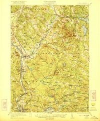
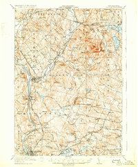
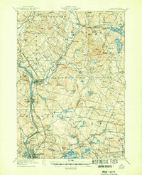
Editions of this 1921 Suncook Map
5 editions found
Other maps of this area

1888 · Haverhill
USGS Topo · 1:62,500

1890 · Haverhill
USGS Topo · 1:62,500

1893 · Haverhill
USGS Topo · 1:62,500

1905 · Manchester
USGS Topo · 1:62,500

1906 · Milford
USGS Topo · 1:62,500

1917 · Mt. Pawtuckaway
USGS Topo · 1:62,500

1919 · Mt. Pawtuckaway
USGS Topo · 1:62,500

1919 · Gilmanton
USGS Topo · 1:62,500

1919 · Alton
USGS Topo · 1:62,500

1921 · Suncook
USGS Topo · 1:62,500