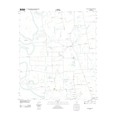
2013 Map of Sunny Side
USGS Topo · Published 2013About this map
The Brazos River forms a winding western boundary for this Waller County landscape, defining the terrain at Wildcat Bend and near oxbow lakes such as Cunny Lake and Hannay Lake. This rural region is anchored by the small communities of Monaville and Sunny Side, which serve as hubs for a network of farm roads and family-named routes. The map is a significant resource for genealogical research, documenting numerous burial grounds including Saint Thomas Cem, Monaville Cem, and President Cem. The transition from river bottomlands to interior prairies is marked by several tributaries, such as Irons Cr and Mulberry Cr, while small aviation sites like Fair Weather Field Airport and Pea Patch Airport reflect the open-space utility of the modern Texas countryside.
Find a feature on this map
74 named features on this map. Tap any name to fly to it.
Don’t see what you’re looking for? This feature index may not catch every label — zoom into the map to look around manually.
Map Details
Editions of this 2013 Sunny Side Map
This is the sole edition of this map. No revisions or reprints were ever made.
Other maps of this area

1920 · Waller
USGS Topo · 1:31,680

1950 · Houston
USGS Topo · 1:250,000

1953 · Seguin
USGS Topo · 1:250,000

1954 · Beaumont
USGS Topo · 1:250,000

1954 · Austin
USGS Topo · 1:250,000

1955 · Brookshire
USGS Topo · 1:62,500

1956 · Sealy
USGS Topo · 1:62,500

1956 · Hempstead
USGS Topo · 1:62,500

1956 · Houston
USGS Topo · 1:250,000

1957 · Beaumont
USGS Topo · 1:250,000