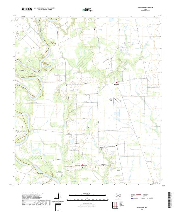
2022 Map of Sunny Side
USGS Topo · Published 2022About this map
Sunny Side and Monaville anchor this landscape along the border of Waller Co and Austin Co in southeastern Texas. The area is defined by a dense network of country roads and family-named cemeteries, reflecting a deeply rooted rural community structure. Notable burial grounds such as Saint Thomas Cem, Williams Cem, and President Cem are scattered across the terrain, often located near the winding courses of Beef Bayou, Mulberry Cr, and Irons Cr. The Brazos River meanders along the western edge, creating the prominent Wildcat Bend and feeding nearby water bodies like Cunny Lake and Hannay Lake. This region balances its agricultural character with local aviation hubs like Pea Patch Airport and Fair Weather Field, suggesting a landscape of private estates and small-scale operations.
Find a feature on this map
65 named features on this map. Tap any name to fly to it.
Don’t see what you’re looking for? This feature index may not catch every label — zoom into the map to look around manually.
Map Details
Editions of this 2022 Sunny Side Map
This is the sole edition of this map. No revisions or reprints were ever made.
Other maps of this area

1920 · Waller
USGS Topo · 1:31,680

1950 · Houston
USGS Topo · 1:250,000

1953 · Seguin
USGS Topo · 1:250,000

1954 · Beaumont
USGS Topo · 1:250,000

1954 · Austin
USGS Topo · 1:250,000

1955 · Brookshire
USGS Topo · 1:62,500

1956 · Sealy
USGS Topo · 1:62,500

1956 · Hempstead
USGS Topo · 1:62,500

1956 · Houston
USGS Topo · 1:250,000

1957 · Beaumont
USGS Topo · 1:250,000