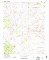
1964 Map of Sunset Flat
USGS Topo · Published 1995About this map
Glen Canyon National Recreation Area defines the high-desert plateaus and drainages of south-central Utah as they appeared in the mid-1960s. The landscape is characterized by a series of prominent level features, including Buckaroo Flat, Sunset Flat, and the expansive Early Weed Bench. These flatlands are dissected by intricate drainage systems such as Little Valley Wash and Twentyfive Mile Wash, which represent the primary water-gathering features of this arid terrain.
Find a feature on this map
18 named features on this map. Tap any name to fly to it.
Don’t see what you’re looking for? This feature index may not catch every label — zoom into the map to look around manually.
Map Details
Editions of this 1964 Sunset Flat Map
2 editions found
Other maps of this area

1886 · Escalante
USGS Topo · 1:250,000

1922 · Rees Canyon
USGS Topo · 1:63,360

1953 · Circle Cliffs 4 NW
USGS Topo · 1:24,000

1953 · Circle Cliffs 4 SW
USGS Topo · 1:24,000

1953 · Moody Creek
USGS Topo · 1:62,500

1956 · Escalante
USGS Topo · 1:250,000

1960 · Escalante
USGS Topo · 1:250,000

1964 · Sunset Flat
USGS Topo · 1:24,000

1964 · Tenmile Flat
USGS Topo · 1:24,000

1964 · Seep Flat
USGS Topo · 1:24,000