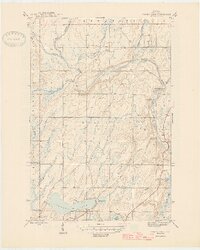
1946 Map of Sunset Lake
USGS Topo · Published 1946About this map
The Paint River and Net River define the northern hydrology of this Iron County landscape, where the confluence marks a transition from winding watercourses to significant riverine features. A notable landmark of previous industrial or logging activity is the Paint Dam (Abandoned), situated just north of where the river system broadens. To the south, the terrain is dotted with glacial lakes, most notably Sunset Lake, which is surrounded by smaller numbered bodies of water like Lake Sixteen and Lake Nine.
Find a feature on this map
21 named features on this map. Tap any name to fly to it.
Don’t see what you’re looking for? This feature index may not catch every label — zoom into the map to look around manually.
Map Details
Editions of this 1946 Sunset Lake Map
2 editions found

Other maps of this area

1895 · Ned Lake
USGS Topo · 1:62,500

1895 · Perch Lake
USGS Topo · 1:62,500

1898 · Iron River
USGS Topo · 1:62,500

1899 · Crystal Falls
USGS Topo · 1:62,500

1944 · Iron River
USGS Topo · 1:24,000

1944 · Gaastra
USGS Topo · 1:24,000

1944 · Fortune Lakes
USGS Topo · 1:24,000

1945 · Gibbs City
USGS Topo · 1:24,000

1945 · Sunset Lake
USGS Topo · 1:24,000

1945 · Amasa
USGS Topo · 1:24,000