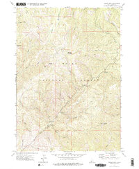
1972 Map of Sunset Mtn.
USGS Topo · Published 1976About this map
Boise National Forest encompasses this high-elevation landscape, where the legacy of early mining and fire management is clearly visible. The summit of Pilot Peak Lookout serves as a central landmark, overlooking a network of steep drainages and peaks including Wilson Peak and Freeman Peak. Historical extraction is evidenced by a Mine Dump and various unnamed Mine and Prospect symbols scattered along the ridgelines and creek beds.
Find a feature on this map
38 named features on this map. Tap any name to fly to it.
Don’t see what you’re looking for? This feature index may not catch every label — zoom into the map to look around manually.
Map Details
Editions of this 1972 Sunset Mtn. Map
3 editions found
Other maps of this area

1894 · Idaho Basin
USGS Topo · 1:125,000

1909 · Garden Valley
USGS Topo · 1:125,000

1955 · Hailey
USGS Topo · 1:250,000

1957 · Pioneerville
USGS Topo · 1:24,000

1957 · Idaho City
USGS Topo · 1:24,000

1957 · Challis
USGS Topo · 1:250,000

1959 · Hailey
USGS Topo · 1:250,000

1959 · Garden Valley
USGS Topo · 1:62,500

1960 · Challis
USGS Topo · 1:250,000

1962 · Hailey
USGS Topo · 1:250,000