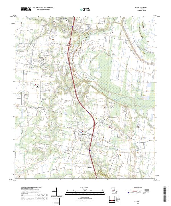
2024 Map of Sunset
USGS Topo · Published 2024About this map
Grand Coteau and Sunset anchor this modern-day view of the Cajun prairie, where the landscape is defined by the transition from the rolling western uplands to the alluvial floor of the Bayou Teche basin. This area of St. Landry Parish is notable for its concentration of historic religious and educational foundations, evidenced by significant landmarks such as the Saint Charles Borromeo Cem and the Cem of the Religious of the Sacred Heart. The transportation network is a layering of old and new, with local roads like Chretien Point Rd and Harry Guilbeau Rd intersecting with modern corridors that skirt smaller communities like Petetin and Shuteston. Further north, the influence of Opelousas begins to show in the denser street grids of Naka and Veltin, while the eastern portion of the map remains more open, dominated by the drainage of Coulée Rouge and the fertile lands of Prairie Laurent.
Find a feature on this map
45 named features on this map. Tap any name to fly to it.
Don’t see what you’re looking for? This feature index may not catch every label — zoom into the map to look around manually.
Map Details
Editions of this 2024 Sunset Map
This is the sole edition of this map. No revisions or reprints were ever made.
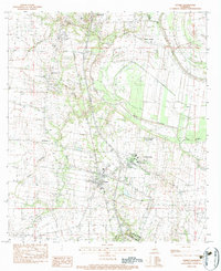
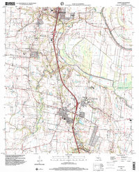
Historical Maps of Opelousas Through Time
3 maps found