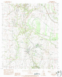
1983 Map of Sunset
USGS Topo · Published 1983About this map
The agrarian landscape of St. Landry Parish in the early 1980s is defined by a dense network of coulees and bayous that drain into Bayou Teche. The map captures the twin settlements of Sunset and Grand Coteau, showing the concentration of institutional landmarks that shaped the local community. St Charles College and the Sacred Heart Academy stand as prominent educational anchors, while the Southern Pacific rail line cuts through the western portion of the region, linking smaller hubs like Shuteston and Veltin to the wider Gulf Coast economy.
Find a feature on this map
24 named features on this map. Tap any name to fly to it.
Don’t see what you’re looking for? This feature index may not catch every label — zoom into the map to look around manually.
Map Details
Editions of this 1983 Sunset Map
This is the sole edition of this map. No revisions or reprints were ever made.
Other maps of this area

1939 · Opelousas
USGS Topo · 1:62,500

1940 · Arnaudville
USGS Topo · 1:62,500

1952 · Lake Charles
USGS Topo · 1:250,000

1954 · Lake Charles
USGS Topo · 1:250,000

1954 · Baton Rouge
USGS Topo · 1:250,000

1956 · Opelousas
USGS Topo · 1:62,500

1956 · Baton Rouge
USGS Topo · 1:250,000

1957 · Opelousas
USGS Topo · 1:62,500

1957 · Carencro
USGS Topo · 1:62,500

1959 · Palmetto
USGS Topo · 1:62,500