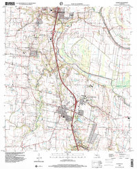
1998 Map of Sunset
USGS Topo · Published 2001About this map
Sunset and Grand Coteau anchor the southern portion of this St. Landry Parish survey, where the prairie landscape is defined by a dense network of watercourses and family landmarks. The area's cultural history is prominent, centered on the campus of St Charles College and the nearby Sacred Heart Academy. A lineage of rural life is visible in the numerous small burial grounds and places of worship, including Bellevue Red Ch, Montgomery Wilkins Cem, and Daly Cem.
Find a feature on this map
22 named features on this map. Tap any name to fly to it.
Don’t see what you’re looking for? This feature index may not catch every label — zoom into the map to look around manually.
Map Details
Editions of this 1998 Sunset Map
This is the sole edition of this map. No revisions or reprints were ever made.
Other maps of this area

1939 · Opelousas
USGS Topo · 1:62,500

1940 · Arnaudville
USGS Topo · 1:62,500

1952 · Lake Charles
USGS Topo · 1:250,000

1954 · Lake Charles
USGS Topo · 1:250,000

1954 · Baton Rouge
USGS Topo · 1:250,000

1956 · Opelousas
USGS Topo · 1:62,500

1956 · Baton Rouge
USGS Topo · 1:250,000

1957 · Opelousas
USGS Topo · 1:62,500

1957 · Carencro
USGS Topo · 1:62,500

1959 · Palmetto
USGS Topo · 1:62,500