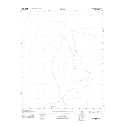
2012 Map of Sunshine Peak
USGS Topo · Published 2012About this map
Sunshine Peak rises as the central landmark of this arid San Bernardino County landscape, surrounded by the geological textures of the Lava Bed Mountains. This 2012 survey illustrates a region dominated by volcanic activity and military operations, notably featuring the distinctive Pisgah Crater in the northeastern corner. Much of the mapped area falls within the boundaries of the 29 Palms MCAG, a Marine Corps Air Ground Combat Center. The absence of traditional settlements or infrastructure, beyond the service roads of the military installation, emphasizes the specialized and restricted nature of this high-desert terrain. For researchers and geologists, the map provides a clear view of the natural drainages and contours of the mountain range as they interact with the massive federal training grounds.
Find a feature on this map
5 named features on this map. Tap any name to fly to it.
Don’t see what you’re looking for? This feature index may not catch every label — zoom into the map to look around manually.
Map Details
Editions of this 2012 Sunshine Peak Map
This is the sole edition of this map. No revisions or reprints were ever made.
Other maps of this area

1953 · San Bernardino
USGS Topo · 1:250,000

1954 · Galway Lake
USGS Topo · 1:24,000

1955 · Lavic SE
USGS Topo · 1:24,000

1955 · Silver Bell Mine
USGS Topo · 1:24,000

1955 · Sunshine Peak
USGS Topo · 1:24,000

1955 · Lavic Lake
USGS Topo · 1:24,000

1955 · Newberry
USGS Topo · 1:62,500

1955 · Lavic
USGS Topo · 1:62,500

1955 · Cady Mountains
USGS Topo · 1:62,500

1955 · Rodman Mountains
USGS Topo · 1:62,500