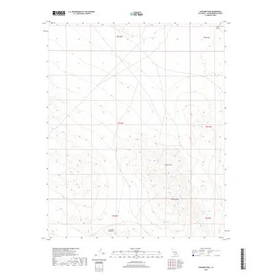
2018 Map of Sunshine Peak
USGS Topo · Published 2018About this map
Sunshine Peak rises as the central landmark in this portion of the Mojave Desert, surrounded by a stark landscape of volcanic activity and high-desert terrain. In the northern reaches of the quadrangle, the distinctive Pisgah Crater marks the landscape near the edge of the Lava Bed Mountains. The map illustrates a complex network of unnamed desert tracks and 4WD roads that navigate the varying elevations, tracing the natural contours between the mountains and the low-lying basins. This 2018 survey provides a clear view of the Public Land Survey System grid, including townships t7n r5e and t8n r6e, which delineate the administrative boundaries across this arid region of San Bernardino County.
Find a feature on this map
10 named features on this map. Tap any name to fly to it.
Don’t see what you’re looking for? This feature index may not catch every label — zoom into the map to look around manually.
Map Details
Editions of this 2018 Sunshine Peak Map
This is the sole edition of this map. No revisions or reprints were ever made.
Other maps of this area

1953 · San Bernardino
USGS Topo · 1:250,000

1954 · Galway Lake
USGS Topo · 1:24,000

1955 · Lavic SE
USGS Topo · 1:24,000

1955 · Silver Bell Mine
USGS Topo · 1:24,000

1955 · Sunshine Peak
USGS Topo · 1:24,000

1955 · Lavic Lake
USGS Topo · 1:24,000

1955 · Newberry
USGS Topo · 1:62,500

1955 · Lavic
USGS Topo · 1:62,500

1955 · Cady Mountains
USGS Topo · 1:62,500

1955 · Rodman Mountains
USGS Topo · 1:62,500