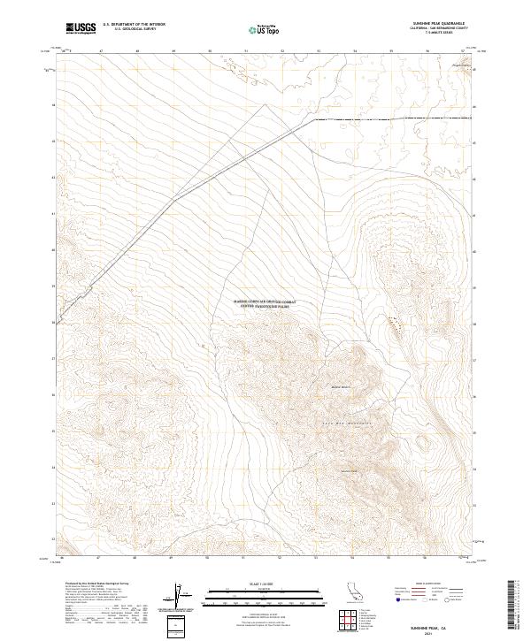
2021 Map of Sunshine Peak
USGS Topo · Published 2021About this map
Pisgah Crater stands as a prominent volcanic landmark in the northeastern corner of this high-desert landscape. The terrain is defined by the volcanic and tectonic history of the Lava Bed Mountains, which dominate the central and southern portions of the quadrangle. As part of the broader Mojave Desert, the area displays a network of unimproved roads and desert tracks that cut across the arid basins between the mountain ranges. The map centers on Sunshine Peak, a high point within the southern massif. This 2021 topographic record reveals the stark topography of the region, emphasizing the drainage patterns and relief of the basaltic formations and cinder cones that characterize this portion of San Bernardino County.
Find a feature on this map
10 named features on this map. Tap any name to fly to it.
Don’t see what you’re looking for? This feature index may not catch every label — zoom into the map to look around manually.
Map Details
Editions of this 2021 Sunshine Peak Map
This is the sole edition of this map. No revisions or reprints were ever made.
Other maps of this area

1953 · San Bernardino
USGS Topo · 1:250,000

1954 · Galway Lake
USGS Topo · 1:24,000

1955 · Lavic SE
USGS Topo · 1:24,000

1955 · Silver Bell Mine
USGS Topo · 1:24,000

1955 · Sunshine Peak
USGS Topo · 1:24,000

1955 · Lavic Lake
USGS Topo · 1:24,000

1955 · Newberry
USGS Topo · 1:62,500

1955 · Lavic
USGS Topo · 1:62,500

1955 · Cady Mountains
USGS Topo · 1:62,500

1955 · Rodman Mountains
USGS Topo · 1:62,500