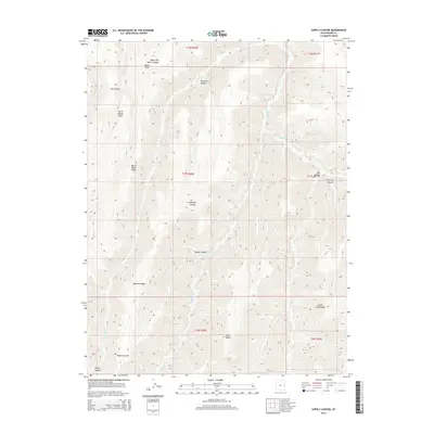
2014 Map of Supply Canyon
USGS Topo · Published 2014About this map
Wagon Road Ridge and Mormon Ridge anchor a high-elevation landscape in eastern Utah, where deep drainages have carved out a series of significant canyons and ridges. The drainage network is particularly dense here, featuring the headwaters and branches of Willow Cr, including its East and West forks, alongside Pioche Cr and Fish Cr. This 2014 survey documents the complex topography of the Book Cliffs region, characterized by named landmarks such as Windy Point and Corral Canyon Point. While lacking permanent settlements, the map reveals a history of movement across the terrain via geographic corridors like Upper Dry Gulch Canyon and Fivemile Canyon. Prominent landforms such as Little Creek Ridge and Went Ridge illustrate the natural barriers and passageways that have long dictated human activity and livestock movement in this part of Grand County.
Find a feature on this map
26 named features on this map. Tap any name to fly to it.
Don’t see what you’re looking for? This feature index may not catch every label — zoom into the map to look around manually.
Map Details
Editions of this 2014 Supply Canyon Map
This is the sole edition of this map. No revisions or reprints were ever made.
Other maps of this area

1885 · East Tavaputs
USGS Topo · 1:250,000

1956 · Grand Junction
USGS Topo · 1:250,000

1959 · Grand Junction
USGS Topo · 1:250,000

1960 · Grand Junction
USGS Topo · 1:250,000

1962 · Grand Junction
USGS Topo · 1:250,000

1963 · Tenmile Canyon
USGS Topo · 1:62,500

1963 · Moonwater Point
USGS Topo · 1:62,500
1963 · Floy Canyon
USGS Topo · 1:62,500

1963 · Sego Canyon
USGS Topo · 1:62,500

1964 · Grand Junction
USGS Topo · 1:250,000