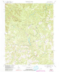
1968 Map of Supply
USGS Topo · Published 1991About this map
Fort A P Hill Military Reservation dominates this central Virginia landscape, a vast military tract established during the 1940s that fundamentally altered local settlement patterns. Before the reservation’s expansion, this area was defined by a dense network of crossroad communities and family-named landmarks. The map records several of these intersections, including Goldmans Corner, Daniel Corner, and Martins Corner, indicating a legacy of small-scale agriculture and landholding that predates the military's arrival.
Find a feature on this map
40 named features on this map. Tap any name to fly to it.
Don’t see what you’re looking for? This feature index may not catch every label — zoom into the map to look around manually.
Map Details
Editions of this 1968 Supply Map
4 editions found
Other maps of this area

1889 · Fredericksburg
USGS Topo · 1:125,000

1892 · Fredericksburg
USGS Topo · 1:125,000

1894 · Fredericksburg
USGS Topo · 1:125,000

1918 · Doswell
USGS Topo · 1:62,500

1918 · Aylett
USGS Topo · 1:62,500

1933 · Aylett
USGS Topo · 1:62,500

1942 · Bowling Green
USGS Topo · 1:31,680

1942 · Upper Zion
USGS Topo · 1:31,680

1942 · Occupacia
USGS Topo · 1:31,680

1942 · Rollins Fork
USGS Topo · 1:31,680