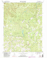
1968 Map of Supply
USGS Topo · Published 2000About this map
The Fort A P Hill Military Reservation dominates the northern landscape of this survey, marking a significant military presence in the rural landscape of Caroline and Essex Counties. This mid-century view captures a network of small, scattered settlements defined by local intersections and forks, such as Hickory Fork, Liberty Fork, and Jacks Fork. To the north, Goldmans Corner and Martins Corner provide evidence of family-named crossroads common to this region's development. The geography is intricately carved by water, with Beverly Run and Mashbor Run feeding into White Lake, while the eastern portion of the sheet is shaped by Portobago Run and Mason Swamp. Genealogists will find interest in the documented locations of Ebenezer Ch and Mt Zion Ch, as well as several marked Cemeteries that anchor these small communities to the land before further modernization of the interior road networks.
Find a feature on this map
29 named features on this map. Tap any name to fly to it.
Don’t see what you’re looking for? This feature index may not catch every label — zoom into the map to look around manually.
Map Details
Editions of this 1968 Supply Map
4 editions found
Other maps of this area

1889 · Fredericksburg
USGS Topo · 1:125,000

1892 · Fredericksburg
USGS Topo · 1:125,000

1894 · Fredericksburg
USGS Topo · 1:125,000

1918 · Doswell
USGS Topo · 1:62,500

1918 · Aylett
USGS Topo · 1:62,500

1933 · Aylett
USGS Topo · 1:62,500

1942 · Bowling Green
USGS Topo · 1:31,680

1942 · Upper Zion
USGS Topo · 1:31,680

1942 · Occupacia
USGS Topo · 1:31,680

1942 · Rollins Fork
USGS Topo · 1:31,680