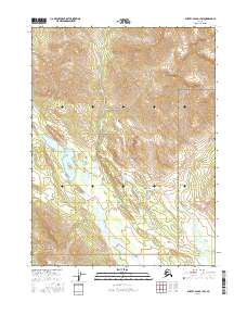
2016 Map of Survey Pass B-1 SW
USGS Topo · Published 2016About this map
Gates of the Arctic National Park encompasses this entire sub-quadrangle, capturing a landscape of high-altitude drainages and steep topography in the northern reaches of Alaska. The terrain is defined by the headwaters of Tobuk Cr, which carves southward through the central valley, and the Iniakuk River, which flows through the southeastern quadrant. This 2016 survey illustrates a purely wilderness environment, devoid of roads, settlements, or structures, reflecting the federally protected status of the land. The map provides precise contour data for the drainages and ridges within Township 23 North and Township 22 North, documenting the hydrological patterns of the Koyukuk watershed before recent shifts in Arctic climate and permafrost stability could alter these remote watercourses.
Find a feature on this map
9 named features on this map. Tap any name to fly to it.
Don’t see what you’re looking for? This feature index may not catch every label — zoom into the map to look around manually.
Map Details
Editions of this 2016 Survey Pass B-1 SW Map
This is the sole edition of this map. No revisions or reprints were ever made.
Other maps of this area

1951 · Survey Pass
USGS Topo · 1:250,000

1956 · Survey Pass
USGS Topo · 1:250,000

1964 · Survey Pass
USGS Topo · 1:250,000

1966 · Survey Pass
USGS Topo · 1:250,000
1986 · Survey Pass A-1
USGS Topo · 1:63,360
1986 · Survey Pass B-2
USGS Topo · 1:63,360
1986 · Survey Pass B-1
USGS Topo · 1:63,360
1986 · Survey Pass A-2
USGS Topo · 1:63,360
2016 · Survey Pass A-2 NE
USGS Topo · 1:25,000
2016 · Survey Pass A-1 NW
USGS Topo · 1:25,000