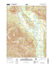
2016 Map of Survey Pass B-2 SE
USGS Topo · Published 2016About this map
The Alatna River meanders through this portion of the Gates Of The Arctic National Park, showcasing the dynamic hydrological patterns of the Alaskan interior. The river's winding course creates numerous oxbows and braided channels, a characteristic feature of this wilderness landscape. To the west, the Takahula Lake sits as a significant water body, fed and drained by the Takahula River. This drainage system, which also includes Millichetah Cr to the north, represents a pristine subarctic ecosystem. The topographic detail provided by this 2016 survey highlights the complex relationship between the valley floor's riparian zones and the surrounding high-altitude terrain, mapped with high precision for modern conservation and navigation.
Find a feature on this map
11 named features on this map. Tap any name to fly to it.
Don’t see what you’re looking for? This feature index may not catch every label — zoom into the map to look around manually.
Map Details
Editions of this 2016 Survey Pass B-2 SE Map
This is the sole edition of this map. No revisions or reprints were ever made.
Other maps of this area

1951 · Survey Pass
USGS Topo · 1:250,000

1956 · Survey Pass
USGS Topo · 1:250,000

1964 · Survey Pass
USGS Topo · 1:250,000

1966 · Survey Pass
USGS Topo · 1:250,000
1986 · Survey Pass A-1
USGS Topo · 1:63,360
1986 · Survey Pass B-2
USGS Topo · 1:63,360
1986 · Survey Pass B-1
USGS Topo · 1:63,360
1986 · Survey Pass A-2
USGS Topo · 1:63,360
2016 · Survey Pass A-2 NE
USGS Topo · 1:25,000
2016 · Survey Pass A-1 NW
USGS Topo · 1:25,000