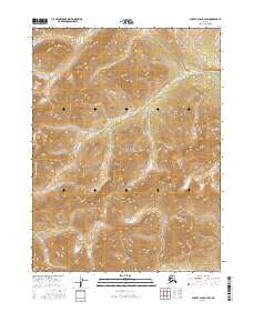
2016 Map of Survey Pass B-2 SW
USGS Topo · Published 2016About this map
Gates of the Arctic National Park encompasses the majority of this high-latitude terrain, where the topographic contours reveal a landscape shaped by extreme elevation changes. The Continental Divide meanders across the lower portion of the sheet, marking the significant hydrologic boundary that separates river drainage systems. Following a winding path through the northern and central sections, the Takahula River serves as the primary water feature, carving through the mountainous terrain of the Brooks Range. This 2016 survey illustrates the undeveloped character of northern Alaska, defined by township and range lines such as t22n r22e and t23n r23e that impose a coordinate system over a vast wilderness without established settlements or roads.
Find a feature on this map
9 named features on this map. Tap any name to fly to it.
Don’t see what you’re looking for? This feature index may not catch every label — zoom into the map to look around manually.
Map Details
Editions of this 2016 Survey Pass B-2 SW Map
This is the sole edition of this map. No revisions or reprints were ever made.
Other maps of this area

1951 · Survey Pass
USGS Topo · 1:250,000

1956 · Survey Pass
USGS Topo · 1:250,000

1964 · Survey Pass
USGS Topo · 1:250,000

1966 · Survey Pass
USGS Topo · 1:250,000
1986 · Survey Pass B-2
USGS Topo · 1:63,360
1986 · Survey Pass A-3
USGS Topo · 1:63,360
1986 · Survey Pass A-2
USGS Topo · 1:63,360
1990 · Survey Pass B-3
USGS Topo · 1:63,360
2016 · Survey Pass A-2 NE
USGS Topo · 1:25,000
2016 · Survey Pass B-3 SE
USGS Topo · 1:25,000