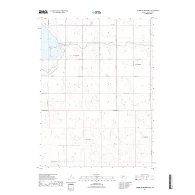
2017 Map of Sutherland Reservoir East
USGS Topo · Published 2017About this map
Lemont Cem sits as a solitary landmark near the northern boundary of this Lincoln County landscape, overlooking a terrain defined by modern water management and agriculture. The western edge of the map is dominated by the expansive Sutherland Reservoir, which feeds into the Outlet Canal as it cuts eastward across the township. This hydrological system reflects the region's 21st-century reliance on irrigation and reservoir storage to support the surrounding plains. The local infrastructure follows a rigid section-line grid, represented by thoroughfares such as Prairie Trace Rd, O'Fallon Rd, and W State Farm Rd. These roads connect isolated farmsteads and agricultural plots, illustrating the persistent rural character of the Nebraska panhandle. The map captures a moment in the 2010s where traditional land use meets large-scale water engineering, providing a clear record for those tracing regional development or family land holdings in the area.
Find a feature on this map
25 named features on this map. Tap any name to fly to it.
Don’t see what you’re looking for? This feature index may not catch every label — zoom into the map to look around manually.
Map Details
Editions of this 2017 Sutherland Reservoir East Map
This is the sole edition of this map. No revisions or reprints were ever made.
Other maps of this area

1898 · Paxton
USGS Topo · 1:125,000

1899 · North Platte
USGS Topo · 1:125,000

1901 · Paxton
USGS Topo · 1:125,000

1902 · North Platte
USGS Topo · 1:125,000

1954 · McCook
USGS Topo · 1:250,000

1954 · North Platte
USGS Topo · 1:250,000

1956 · North Platte
USGS Topo · 1:250,000

1957 · North Platte
USGS Topo · 1:250,000

1957 · McCook
USGS Topo · 1:250,000

1958 · McCook
USGS Topo · 1:250,000