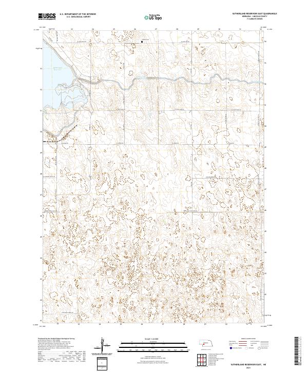
2021 Map of Sutherland Reservoir East
USGS Topo · Published 2021About this map
Sutherland Reservoir dominates the northwestern corner of this Lincoln County landscape, serving as a focal point for the regional water management system that defines this part of Nebraska. The Outlet Canal flows eastward from the reservoir, cutting through the section lines of Township 13 North. This engineering feat is contrasted by the traditional grid of rural section roads, including W State Farm Rd and W Power Rd, which organize the surrounding agricultural land. For those researching local history or genealogy, the Lamont Cem sits just north of the canal near S Lamont Rd, a small but significant landmark for the area's rural families. The map also captures the distinct transition between the irrigated lowlands near the water and the rising terrain marked by local landmarks like S Hershey Dickens Rd and Prairie Trace Rd.
Find a feature on this map
25 named features on this map. Tap any name to fly to it.
Don’t see what you’re looking for? This feature index may not catch every label — zoom into the map to look around manually.
Map Details
Editions of this 2021 Sutherland Reservoir East Map
This is the sole edition of this map. No revisions or reprints were ever made.
Other maps of this area

1898 · Paxton
USGS Topo · 1:125,000

1899 · North Platte
USGS Topo · 1:125,000

1901 · Paxton
USGS Topo · 1:125,000

1902 · North Platte
USGS Topo · 1:125,000

1954 · McCook
USGS Topo · 1:250,000

1954 · North Platte
USGS Topo · 1:250,000

1956 · North Platte
USGS Topo · 1:250,000

1957 · North Platte
USGS Topo · 1:250,000

1957 · McCook
USGS Topo · 1:250,000

1958 · McCook
USGS Topo · 1:250,000