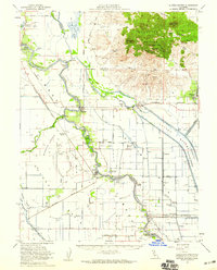
1954 Map of Sutter Buttes
USGS Topo · Published 1959About this map
Sutter Buttes rise sharply from the floor of the Sacramento Valley, dominated by peaks like North Butte and South Butte. This unique volcanic formation stands as a landmark in a landscape otherwise defined by the complex water management systems of the mid-1950s. The Sacramento River and its accompanying Colusa Weir and Sutter Bypass show the intensive engineering required to manage the floodplains. Scattered agricultural settlements such as Meridian, Grimes, and Sutter are connected by the Southern Pacific railroad and local routes like Wood Road. The presence of the Sutter Nat Wildlife Refuge and the Butte Sink underscores the area's importance as a seasonal wetland. For the researcher, the map preserves the locations of local institutions like Stohlman Cemetery and the Grand Island School, alongside river-related sites like Eddys Ferry (Site).
Find a feature on this map
54 named features on this map. Tap any name to fly to it.
Don’t see what you’re looking for? This feature index may not catch every label — zoom into the map to look around manually.
Map Details
Editions of this 1954 Sutter Buttes Map
3 editions found
Other maps of this area

1888 · Marysville
USGS Topo · 1:125,000

1891 · Marysville
USGS Topo · 1:125,000

1894 · Marysville
USGS Topo · 1:125,000

1895 · Marysville
USGS Topo · 1:125,000

1905 · Harrington
USGS Topo · 1:24,000

1906 · Maxwell
USGS Topo · 1:62,500

1907 · Dunnigan
USGS Topo · 1:62,500

1907 · Colusa
USGS Topo · 1:62,500

1910 · Marcuse
USGS Topo · 1:31,680

1911 · Sutter
USGS Topo · 1:31,680