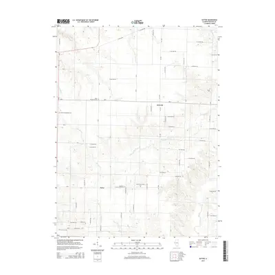
2015 Map of Sutter
USGS Topo · Published 2015About this map
Sutter and Elderville anchor this Hancock County landscape, where the agricultural grid is deeply etched by a branching drainage system. The terrain is defined by the winding paths of Little Bear Cr and Crystal Glen Cr, which carve through the prairie to create localized relief. For those tracing local genealogy or congregational history, the map is remarkably dense with legacy sites. Numerous burial grounds and houses of worship are preserved here, including the Wythe Presbyterian Cem and the Bethlehem Church of Christ Cem. The intersection of E Highway 96 and the township road system illustrates the modern connectivity of these rural communities, while family-named landmarks like Walker Cem and McGee Cem provide concrete links to the families who established these farmsteads.
Find a feature on this map
39 named features on this map. Tap any name to fly to it.
Don’t see what you’re looking for? This feature index may not catch every label — zoom into the map to look around manually.
Map Details
Editions of this 2015 Sutter Map
This is the sole edition of this map. No revisions or reprints were ever made.
Other maps of this area

1933 · Carthage
USGS Topo · 1:62,500

1936 · Keokuk
USGS Topo · 1:62,500

1937 · Carthage
USGS Topo · 1:62,500

1946 · Mendon
USGS Topo · 1:62,500

1948 · Mendon
USGS Topo · 1:62,500

1948 · Camp Point
USGS Topo · 1:62,500

1950 · Keokuk
USGS Topo · 1:62,500

1958 · Burlington
USGS Topo · 1:250,000

1961 · Burlington
USGS Topo · 1:250,000

1963 · Burlington
USGS Topo · 1:250,000