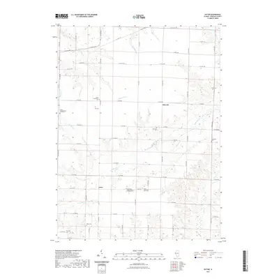
2021 Map of Sutter
USGS Topo · Published 2021About this map
The agricultural landscape of Hancock County reveals a deep-rooted community history centered around Sutter and Elderville. This region is defined by an extensive network of family and congregational sites, ranging from the Wythe Congregational Church Cem to the Sutter Salem Bible Church Cem. The topography is etched by numerous drainage systems such as Little Bear Cr, Crystal Glen Cr, and Rocky Run, which create the undulating terrain typical of the Illinois prairie. The dense distribution of small burial grounds like Kiser Cem and Oak Grove Cem suggests a long-established settlement pattern where early residents remained close to their original homesteads. A grid of county roads, including Co HWY 23 and E Co RD 900, provides the modern framework for navigating this quiet rural expanse, where the legacy of early Bethlehem United Church of Christ Cem congregants and local families is still preserved on the land.
Find a feature on this map
36 named features on this map. Tap any name to fly to it.
Don’t see what you’re looking for? This feature index may not catch every label — zoom into the map to look around manually.
Map Details
Editions of this 2021 Sutter Map
This is the sole edition of this map. No revisions or reprints were ever made.
Other maps of this area

1933 · Carthage
USGS Topo · 1:62,500

1936 · Keokuk
USGS Topo · 1:62,500

1937 · Carthage
USGS Topo · 1:62,500

1946 · Mendon
USGS Topo · 1:62,500

1948 · Mendon
USGS Topo · 1:62,500

1948 · Camp Point
USGS Topo · 1:62,500

1950 · Keokuk
USGS Topo · 1:62,500

1958 · Burlington
USGS Topo · 1:250,000

1961 · Burlington
USGS Topo · 1:250,000

1963 · Burlington
USGS Topo · 1:250,000