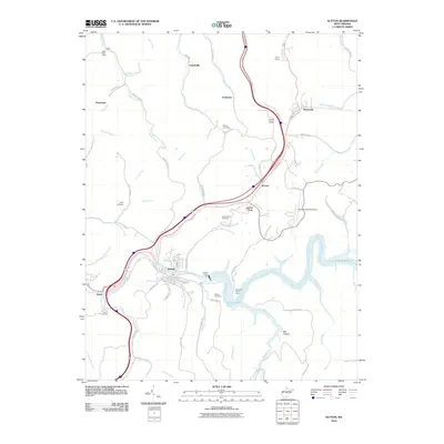
2010 Map of Sutton
USGS Topo · Published 2010About this map
Sutton serves as the focal point of this Braxton County survey, situated at a strategic bend of the Elk River just downstream from the massive Sutton Dam. The creation of Sutton Lake has fundamentally altered the local geography, with fingers of the reservoir extending into valleys like Bee Hollow and Wolf Creek. This 2010 edition illustrates the modern infrastructure of the region, including the Braxton County Airport and the commercial corridor extending toward Flatwoods.
Find a feature on this map
81 named features on this map. Tap any name to fly to it.
Don’t see what you’re looking for? This feature index may not catch every label — zoom into the map to look around manually.
Map Details
Editions of this 2010 Sutton Map
This is the sole edition of this map. No revisions or reprints were ever made.
Other maps of this area

1893 · Sutton
USGS Topo · 1:125,000

1906 · Glenville
USGS Topo · 1:62,500

1906 · Burnsville
USGS Topo · 1:62,500

1908 · Gassaway
USGS Topo · 1:48,000

1908 · Sutton
USGS Topo · 1:48,000

1910 · Sutton Special
USGS Topo · 1:62,500

1910 · Gassaway
USGS Topo · 1:62,500

1925 · Glenville
USGS Topo · 1:62,500

1925 · Burnsville
USGS Topo · 1:62,500

1927 · Burnsville
USGS Topo · 1:62,500