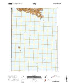
2019 Map of Sutwik Island D-2 NW
USGS Topo · Published 2019About this map
Cape Providence anchors the northern coastline of this maritime survey, marking a prominent point where the Alaska Peninsula meets the Pacific Ocean. The landscape is defined by its coastal landforms, including the sheltered waters of Chiginagak Bay to the west. Farther south, the isolated Atugnak Columns rise from the sea, serving as a distinctive navigational landmark in these remote waters. This topographic study emphasizes the intersection of land and sea, documenting the precise shoreline and bathymetric orientation of the Lake and Peninsula Borough as it stood in the early 21st century. The map is primarily an aquatic record, illustrating the vast reach of the open ocean against the rugged, surveyed boundaries of the peninsula.
Find a feature on this map
7 named features on this map. Tap any name to fly to it.
Don’t see what you’re looking for? This feature index may not catch every label — zoom into the map to look around manually.
Map Details
Editions of this 2019 Sutwik Island D-2 NW Map
This is the sole edition of this map. No revisions or reprints were ever made.
Other maps of this area

1943 · Ugashik
USGS Topo · 1:250,000

1948 · Ugashik
USGS Topo · 1:250,000

1949 · Ugashik
USGS Topo · 1:250,000

1951 · Sutwik Island
USGS Topo · 1:250,000

1951 · Ugashik A-2
USGS Topo · 1:63,360

1954 · Ugashik A-3
USGS Topo · 1:63,360

1954 · Sutwik Island D-3
USGS Topo · 1:63,360

1963 · Sutwik Island
USGS Topo · 1:250,000

1963 · Ugashik
USGS Topo · 1:250,000
1989 · Sutwik Island D-2
USGS Topo · 1:63,360