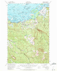
1955 Map of Svensen
USGS Topo · Published 1972About this map
Columbia River riverfront life and the rugged timberlands of Clatsop County dominate this mid-century topographic record. The northern edge of the map reveals a complex aquatic landscape of islands and channels, including Karlson Island, Marsh Island, and the Prairie Channel, which facilitated the region's historical waterborne commerce. On the mainland, the Spokane Portland and Seattle railroad and highway corridor connects riverfront settlements like Svensen, Knappa, and Burnside.
Find a feature on this map
65 named features on this map. Tap any name to fly to it.
Don’t see what you’re looking for? This feature index may not catch every label — zoom into the map to look around manually.
Map Details
Editions of this 1955 Svensen Map
3 editions found
Other maps of this area

1919 · Astoria
USGS Topo · 1:62,500

1938 · Fort Columbia
USGS Topo · 1:62,500

1939 · Astoria
USGS Topo · 1:62,500

1939 · Saddle Mountain
USGS Topo · 1:62,500

1940 · Svensen
USGS Topo · 1:62,500

1940 · Brookfield
USGS Topo · 1:62,500

1940 · Cape Falcon
USGS Topo · 1:62,500

1941 · Keasey
USGS Topo · 1:62,500

1941 · Skamokawa
USGS Topo · 1:62,500

1941 · Cathlamet
USGS Topo · 1:62,500